AFRICA unit Study
|
|
Our travels will take us to: Egypt, Kenya, Uganda, Sudan, South Africa and Niger
This study includes inspiring information on a variety of different countries in AFRICA and focuses on Geography, Science and Art lessons. In addition we are including short biographical studies of famous people who made a difference in African countries. Designed to be more than just geography lessons; this study will encourage thought provoking questions about the culture, regional differences and world interaction. |
Geography and Country Facts

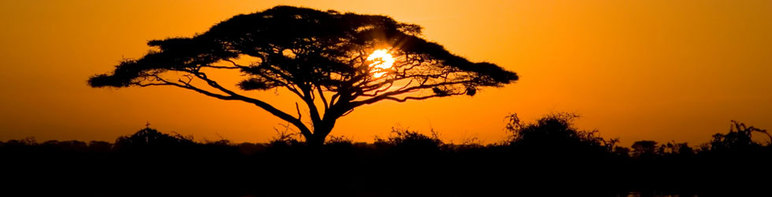
The continent of Africa covers nearly 12 million square miles (31 million sq. km).
How big is that, you wonder?
It's BIG! Africa could hold the land occupied by China, India, Europe, Argentina, New Zealand and the continental United States, with room to spare!
You've probably heard of some African countries...places like Egypt, Nigeria and Kenya.
However, Africa is divided into over 40 different countries!
Here are some quick facts to add to your notebook pages:
- Africa is the second largest continent
- The equator runs through the middle of Africa
- Africa is surrounded by the Atlantic and Indian Oceans
- Africa has deserts, rain forest, and grassy savannas
- It has the largest desert and the longest river in the world
This unit study will focus on several different countries as they relate to our history lessons. Many resources will be included to help you with additional country studies! Honestly I would LOVE to explore the entire continent and all 50 plus countries but at this time we can't..however, there is a wonderful resource at TeachersPayTeachers.com of a complete unit study of all the countries. We just might have to pick it up for summer learning.
- find more resources at St Aiden AFRICA
- Here's a printable with maps and labels
- Free Printable of African Flags, part 2 African Flags
Language
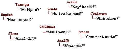
As of 1993, African people used more than 800 languages and regional varieties of a language, or dialects. We listened to the following languages:
Arabic - spoken and written alphabet
Swahili - upbeat song to help you learn greetings
French
But only 10 or so of those languages are spoken by cultural groups of more than a million people. In fact, most African languages are used by groups of fewer than 100,000 people.
Arabic - spoken and written alphabet
Swahili - upbeat song to help you learn greetings
French
But only 10 or so of those languages are spoken by cultural groups of more than a million people. In fact, most African languages are used by groups of fewer than 100,000 people.
Deep Space Sparkle has a wonderful downloadable lesson plans for sale
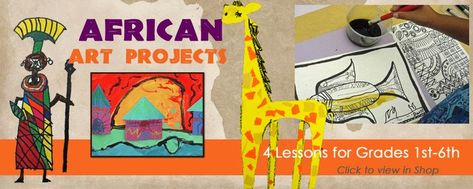
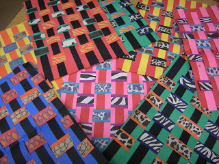
ARTS and CRAFTS: free art and activities for Africa Unit Study
visit our pinterest board African Art for more inspiration!
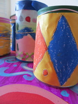
Tin Can Drums to go along with our storytimeonline.net
TO BE A DRUM
|
|

|
|
MUSIC
Dance, music, and story-telling are among the ancient art forms that have flourished for many centuries in Africa. Music and dance are terms that we will use to denote musical practices of African people.
African music, which is nearly always coupled with some other art form, expresses the feelings and life of the entire community. The sound of feet pounding the ground becomes the rhythm of the music whose notes are in turn transformed into dance steps.-Francis Bebey (African Musician and Scholar)
Broadly speaking, there are both similarities and differences between Western music and African music and it is in this domain of diversity that African music is best discovered. The elements of African music (rhythm, melody, harmony, musical instruments, meter, and timbre, et al.) are, broadly speaking, those of Western music. However, the unique features of each element of African music contain the essence of what makes African music unique in the World. Read more about African Music
Instruments can be broken down into five groups (after C. Sachs): idiophones - instruments made of naturally sonorous material not needing additional tension to create sound; examples, percussion or concussion instruments; membranophones - instruments creating sound be stretching a membrane over an opening; example, drums; aerophones - instruments usually referred to by the term 'wind instruments' and most often needing the breath of the player to create sound; examples, trumpets and horns; chordophones - instruments creating sound by the action of a stretched string in vibrating motion; example, any string instrument; electrophones - instruments creating sound by the oscillation of electric circuits; example, music synthesizers.
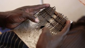
We were especially enthralled by the 'thumb piano'
|
|
|
SCIENCE
African Landscape and Features
|
|
|
The Sahara Desert
Tour of the Sahara (this is a teacher's answer sheet PERFECT to summarize and help students with notebooking key concepts sadly the link to the pbs show is no longer valid
A magazine style text written to the students about the Sahara Desert, talks about sand dunes, fossil fuel and solar energy interesting reading
Camels - "Ships of the Desert”
Camels are called “Ships of the Desert” because they are uniquely adapted to survive the harsh conditions of the desert habitat. They have large flat feet with leathery pads and two toes on each foot. When the camel places its foot on the ground the pads spread out preventing the foot from sinking into the sand. Their eyes are protected by a double row of long curly eyelashes that help keep sand and dust out of their eyes. They have a third eyelid which acts like a windshield wiper to ash sand out of their eyes. Thick bushy eyebrows shield the eyes from the desert sun. Their ears are lined with fur to keep sand from blowing into the ear canal. Even their nostrils close to keep out
the sand. Fun Facts
• 90% of the world’s camels are Arabian (dromedary) camels.
• Camels are used as beasts of burden but they also provide 11-17 pounds of wool and up to 1056 pints of milk per year. Camel milk is used to make butter and different kinds of cheese.
• Camels have a cleft in their upper lip to catch moisture from the nostrils.
• Camel hair is used to make clothing and tents for desert nomads.
• Camels can go 3 days (and sometimes longer!) without water.
A- Z of Camels- text page filled with research question answers
Camel Lapbook - from Homeschool Share
|
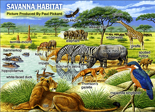
The Savannah
A Nice visual site for younger readers to help with their notebooking/research pages Bringing Rain to the Kapati Plain - I LOVE HIS VOICE. the children did NOT like the story. Too repetitive. _ BBC Program (we edited for time and content focusing on the beginning 5 minutes, a few in the middle about the nocturnal animals and the end showing the rains returning.) We all chose an animals to discover more about. Student 'research' to be provided shortly!
|
|
coming soon. Students are working on these biographies for Sept 2013 |

Homeschool Creations is a wonderful resource stop for any unit study on Africa. She creates simple Printables that we use in our new adventure of Notebooking.
 This is a link to a very detailed ancient Egypt unit study. I like how its assembled in a manila envelope bound book so all the pieces/notebook pages stay together.
|
Sudan
South Africa |
|
South African GEOGRAPHY and countries facts
free printable are here: MAPS (labeled and unlabeled). Here's a great map geography worksheet by Homeschool Creations
TIMELINE information
(more information about the maps and timeline at Knowledge Quest)
Africa is a continent - filled with many different countries. We are going to explore several.
Starting with SOUTH AFRICA
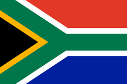
FLAG:
The national flag was designed by a former South African State Herald, Mr Fred Brownell, and was first used on 27 April 1994. The design and colours are a synopsis of principal elements of the country’s flag history. Individual colors, or color combinations represent different meanings for different people and therefore no universal symbolism should be attached to any of the colors.
South Africa is renowned for its wines and is one of the world's largest producers of gold. South Africa has the strongest economy in Africa, and is an influential player in African politics. South Africa is one of the most unequal countries in the world where opulence and severe poverty can often be observed together. The rural part of South Africa remains among the poorest and the least developed parts of the world and poverty in the townships can be appalling, progress is being made.
History
A quick summary of the long history of the country can be found here
Culture
free printable are here: MAPS (labeled and unlabeled). Here's a great map geography worksheet by Homeschool Creations
TIMELINE information
(more information about the maps and timeline at Knowledge Quest)
Africa is a continent - filled with many different countries. We are going to explore several.
Starting with SOUTH AFRICA
FLAG:
The national flag was designed by a former South African State Herald, Mr Fred Brownell, and was first used on 27 April 1994. The design and colours are a synopsis of principal elements of the country’s flag history. Individual colors, or color combinations represent different meanings for different people and therefore no universal symbolism should be attached to any of the colors.
South Africa is renowned for its wines and is one of the world's largest producers of gold. South Africa has the strongest economy in Africa, and is an influential player in African politics. South Africa is one of the most unequal countries in the world where opulence and severe poverty can often be observed together. The rural part of South Africa remains among the poorest and the least developed parts of the world and poverty in the townships can be appalling, progress is being made.
History
A quick summary of the long history of the country can be found here
Culture
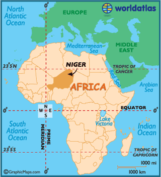
Niger
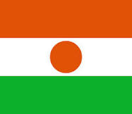
Niger African GEOGRAPHY and countries facts Niger is a former French colony which was granted independence in 1960. Niger is a vast landlocked country with an estimated population of 15 million, the majority of whom live along a narrow band of arable land on the country’s southern border. Families make their living with agriculture. Drought has left many struggling. The land is mostly desert plains and dunes, with rolling savanna in the southeast. The harsh land is compounded by the fact that terrorist groups operate in the country and it is very dangerous. Areas near the Mali border are essentially lawless, and travel near the border is very dangerous, especially since the beginning of the Tuareg/Islamist insurgency in March 2012. -wikitravel Here's a link to team of homeschooling educators who have already created a complete unit study with hands on activities and free printable for this country. Guidan Gado Raise a Village Campaign the Niger Unit Study
Local, traditional food includes:
|
You might be interested in these related posts from Parents.com/homeschool den
|
|
|
